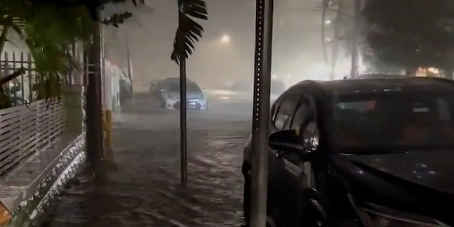
Torrential rain and powerful winds knocked out power across South Florida metro areas and prompted school closures on Thursday.
Overnight flash flood warnings expired early Thursday, but South Florida could see periodic light rainfall through the day, particularly along the East Coast.
Flood watches that affected millions across southeastern Florida have ended but a watch remained in place for nearly 1.5 million people along eastern Florida through the evening. High wind alerts are also in place across southern and eastern Florida, with 60 mph gusts expected in some areas.
As of around 7 a.m. Thursday, more than 125,000 homes and businesses were without power in Florida, with Miami-Dade County accounting for more than half of those outages, according to outage tracking website Poweroutage.us.
Even though the heaviest rainfall moved off the southeastern coast of Florida Thursday morning, rain was still impacting areas where the soil is already saturated.
“Drainage will be difficult in many coastal areas due (to) the high tide. Flash flooding is ongoing or expected to begin shortly,” the weather service in Miami warned.
The torrential rainfall comes just months after a 1-in-1,000-year rain event led to the rainiest day on record in Fort Lauderdale, when 22.5 inches fell on April 12, submerging roads and neighborhoods and forcing the airport to close. Southeast Florida took the brunt of the blow, with rainfall totals approaching double digits. Areas around Fort Lauderdale, Miami, and southwest into the Florida Keys had widespread 48-hour rainfall totals of 6 to 9 inches.
By Wednesday night, Miami was drenched with 6.73 inches of rain within the previous 24 hours, while Hollywood received 5.62 inches and Fort Lauderdale saw 4.2 inches of rainfall during roughly the same time period, according to preliminary reports from the National Weather Service.
Broward County Public Schools canceled classes and closed administrative offices Thursday due to safety concerns, the district said on its website. Broward College in Fort Lauderdale will close Thursday for the second day in a row due to flooding in surrounding areas, the school said online. Meanwhile, in Lauderdale Lakes, located in Broward County, wind gusts toppled over a tree and destroyed two cars affiliate WSVN reported Wednesday. Spiro Marchelos, the owner of Anglers Beach Cafe, gave his employees the day off due to the conditions.
“It’s a loss of revenue, but we have no choice,” he told the outlet. “The weather is bad, and people aren’t going to come to the beach today. It’s windy, rainy, and the streets are flooded.”
There is a slight risk for excessive rainfall, level 2 of 4, along the eastern coast of Florida on Thursday, according to the Weather Prediction Center. A marginal risk for excessive rainfall, level 1 of 4, is in place over southeastern Florida through Thursday.
South Florida Drenched This Week
Portions of Palm Beach County and Broward County – where Fort Lauderdale is located – saw 3 to 6 inches of rain on Tuesday and stand to get an additional 8 to 10 inches through Thursday. Three-day rainfall totals in excess of a foot are not out of the question in these areas. Fort Lauderdale has already had an abnormally wet year, and this week’s rain will likely be enough to push the city into record territory. As of Wednesday morning, the city had recorded 100 inches of rain this year, just shy of its wettest year on record – 102.36 inches in 1947.
And now Greg Brandenburg of Fort Lauderdale is bracing for the worst.
“It’s just so much rain that we’ve had this year, it’s crazy,” he told WSVN. “Now we got this rain situation coming back again. It’s just tiring.”
The torrential rainfall rates and accumulation totals through Thursday across southeastern Florida will lead to “a higher probability of flash flooding concerns within the urban corridor down into the Florida Keys north of Marathon,” according to the Weather Prediction Center.
Saturated ground and ongoing king tides could slow the water from receding in coastal communities that flood this week.
On April 12, Fort Lauderdale experienced the rainiest day in its history, sparking a flash flood emergency in Broward County that prompted emergency rescues, forced drivers to abandon cars, shuttered schools, and shut down the airport. During the peak of the deluge, a month’s worth of rain fell in just one hour.
Extreme rainfall is a signature consequence of a warming climate, and it is happening more frequently. The deluge in South Florida was the latest instance after 1-in-1000 year rains also struck in areas including Dallas, St. Louis, eastern Kentucky, and Yellowstone.
In conclusion, South Florida is once again grappling with the aftermath of extreme weather, as torrential rain and powerful winds have left thousands without power and caused school closures. The region’s vulnerability to heavy rainfall and flooding has become all too familiar, with a 1-in-1,000-year rain event just months ago and ongoing bouts of excessive rainfall this year.
Residents and businesses in Fort Lauderdale and the surrounding areas are facing the challenges of a record-breaking rainy year, with the possibility of more rainfall pushing the city into uncharted territory. While the immediate concern is flash flooding, the long-term impact of such extreme weather events underscores the broader issue of climate change, which is leading to more frequent and intense rainfall events across the country.
As South Florida continues to deal with the consequences of these weather extremes, it serves as a stark reminder of the need for climate resilience and preparedness in the face of a changing climate.


Leave a Reply